Draw a geozone
You will draw one watched area on a map — a circle or a many-sided shape — give it a name, and save it. From then on the area can be used by alert policies.
Before you start
- Your role must allow you to create geozones (Supervisor, Operational manager and System admin can). If it does not, the Add geozone button is not on the Geozones screen.
- Know roughly where the area is. The editor has no address search and no place to type coordinates: you find the spot by moving and zooming the map.
- Decide the shape before you start. A circle suits a place you think of as "within so many metres of here" — a weighbridge, a rest stop. A polygon suits a place with edges — a yard, a terminal, a border post.
- Pick a name no other zone uses. Two zones in use cannot share a name.
Open the editor
- Open Configuration → Geofencing in the sidebar.
- Select Add geozone at the top right.
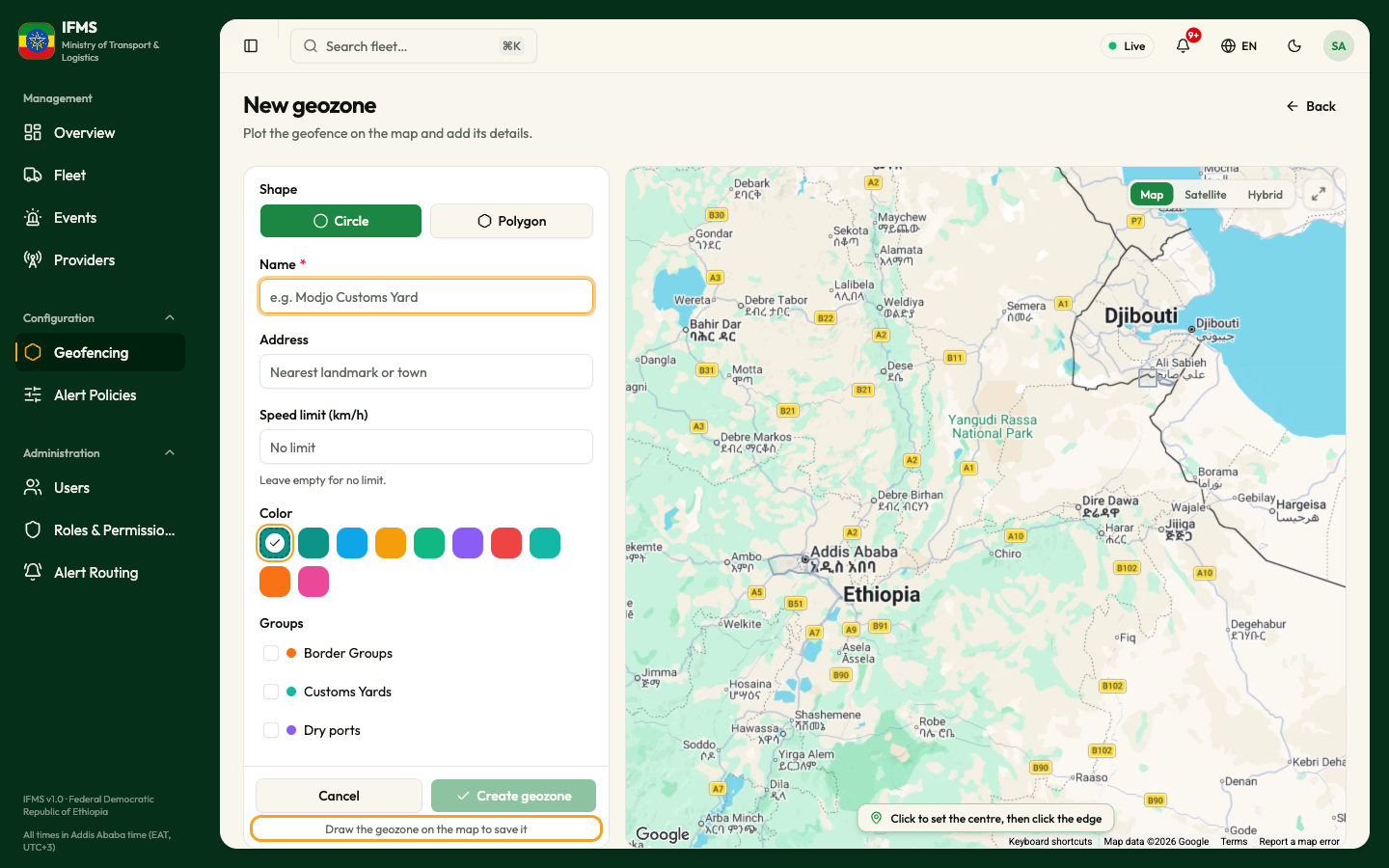
The screen is titled New geozone, with the line "Plot the geofence on the map and add its details." The details are on the left and the drawing map is on the right. Zones that already exist are drawn in grey for guidance; you cannot select them here.
Choose the shape
Shape offers two buttons, Circle and Polygon. Circle is chosen when the screen opens; the chosen one is filled in green.
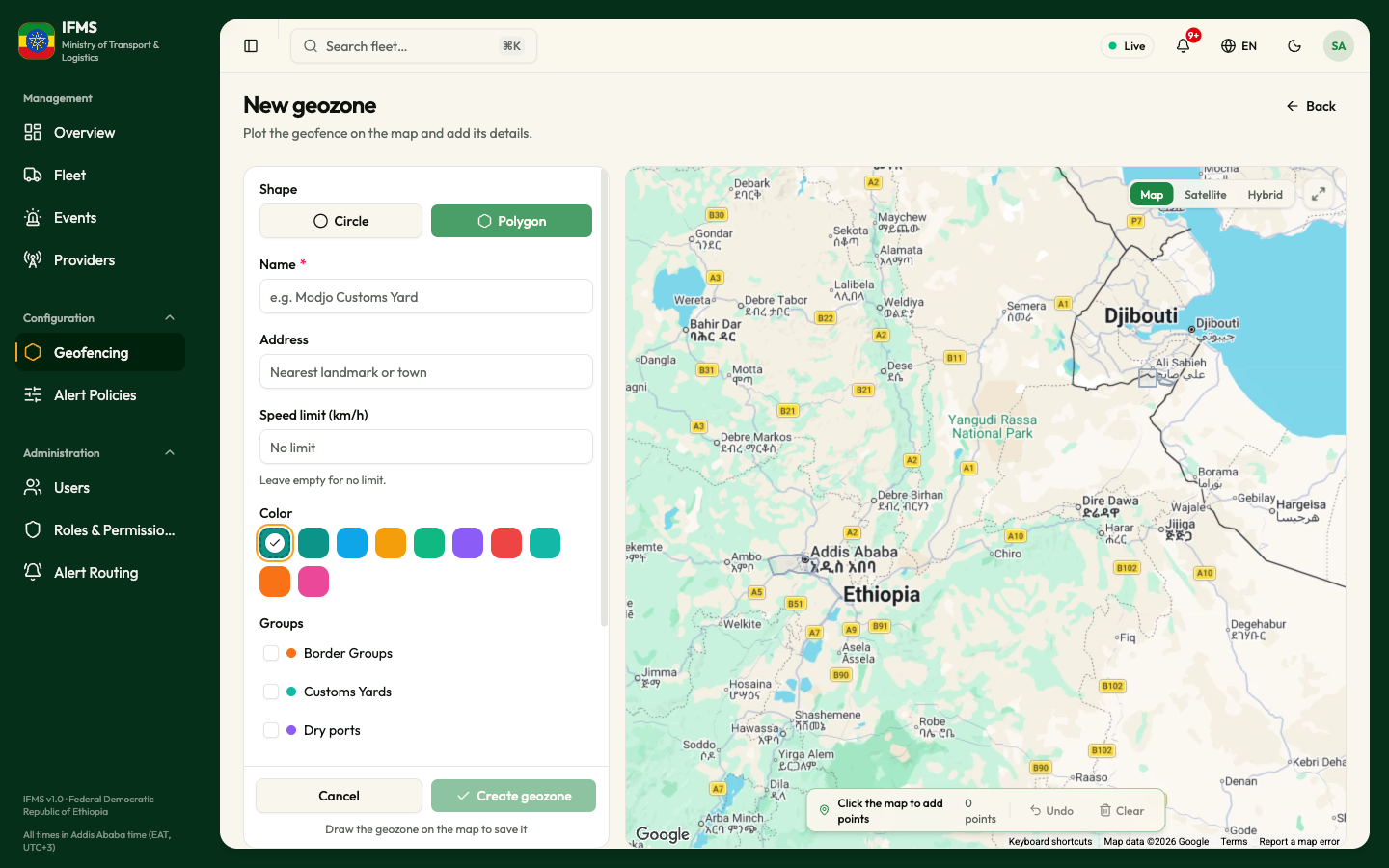
If you have already drawn something and select the other shape, IFMS asks Discard unsaved changes? Select Discard to clear the drawing and start the new shape, or Cancel to keep what you drew.
Draw a circle
- Select Circle.
- Move and zoom the map until the area is in view.
- Click once in the middle of the area. A dot marks the centre and a preview circle follows your pointer.
- Click again on the edge you want. The distance between the two clicks becomes the radius, rounded to whole metres.
- Check the Geometry box at the bottom of the details panel. It now reads, for example, Centre 11.7705, 41.0084 · 607 m radius.
To adjust the circle, drag it to move it, or drag one of the small handles on its edge to make it larger or smaller. Geometry follows as you drag. To start again, select Redraw on the map toolbar.
There is no box for typing a radius or coordinates. If you need an exact radius, zoom in and use the scale at the bottom of the map, then check the metres shown in Geometry.
Draw a polygon
- Select Polygon.
- Click each corner of the area in turn. Every click adds a point; from the second point on, the outline is drawn as you go.
- Watch the counter on the map toolbar — 3 points, 4 points — and the Geometry box, which shows the same number.
- There is no finishing click. As soon as you have three points or more the shape is complete; IFMS joins the last point back to the first when it saves.
While you add points:
| Button | What it does |
|---|---|
| Undo | Removes the last point you added. |
| Clear | Removes every point and starts the shape again. |
Adjust the outline
Once the shape has three points, the toolbar shows two buttons: Add points and Move points.
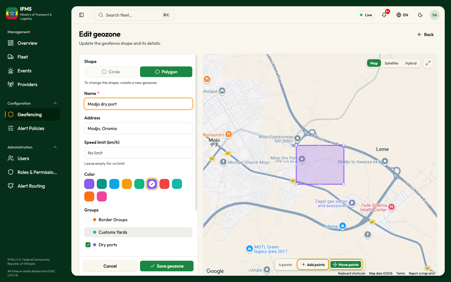
- Select Move points. Handles appear on the outline.
- Drag a corner to move it.
- Drag the small handle halfway along an edge to add a corner there.
- Drag inside the shape to move the whole of it.
- Select Add points to go back to clicking new corners at the end of the outline. Undo and Clear are only shown in this mode.
Fill in the details
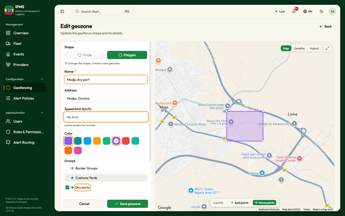
| Field | Required | What to enter | Rules and messages |
|---|---|---|---|
| Shape | — | Circle or Polygon. | When you edit an existing zone the shape cannot be changed: the other button is greyed out, with the line "To change the shape, create a new geozone." |
| Name | Yes | What the area is called, as operators will read it in alerts and reports — for example "Modjo dry port". | Leaving it empty gives the message Geozone name is required. Up to 120 characters. No other zone in use may have the same name — capitals and spaces at either end do not count — otherwise Another geozone already uses this name. appears in red under the field. The name of a deleted zone can be reused. |
| Address | No | The nearest landmark or town, shown as the second line in the list — for example "Modjo, Oromia". | Up to 400 characters. |
| Speed limit (km/h) | No | The speed limit inside the zone, in whole kilometres per hour. | Leave it empty for no limit. Alert policies set to Use zone's limit compare a vehicle's speed with this number. |
| Color | — | Use group colour (the first, dashed square), or one of nine colours. The chosen one carries a tick. | A new zone starts on Use group colour: it is drawn in the colour of its first group in alphabetical order, or teal when it is in no group. Choose a colour to give the zone its own. |
| Groups | No | Tick each group the zone belongs to. A zone can be in several groups, or none. | The groups are saved together with the zone. "No groups yet." means no group exists. |
| Note | No | Anything operators should know about the place, such as "trucks wait here for customs clearance". | Up to 400 characters. |
| Geometry | Yes | Not typed — it fills itself as you draw. | Nothing plotted yet until you draw. Then Centre lat, lng · N m radius for a circle, or N points for a polygon. |
A new zone is always active; you switch it off afterwards from the list.
Save
- Check the Geometry box shows your shape. Until a circle is plotted or a polygon has three points, the Create geozone button is greyed out, with the line "Draw the geozone on the map to save it" under it.
- Select Create geozone.
The message Geozone created confirms it and you land back on Geozones with your new zone selected and framed on the map.
Cancel or Back leaves without saving. If you have changed anything, IFMS first asks Discard unsaved changes? ("Your changes to this geozone will be lost."): select Discard to leave, or Cancel to stay. The same question appears when you select a sidebar link. Closing or reloading the browser tab brings up your browser's own warning instead.
Change a zone you drew earlier
- On Geozones, find the zone.
- Select the ⋯ button on its row, then Edit geozone.
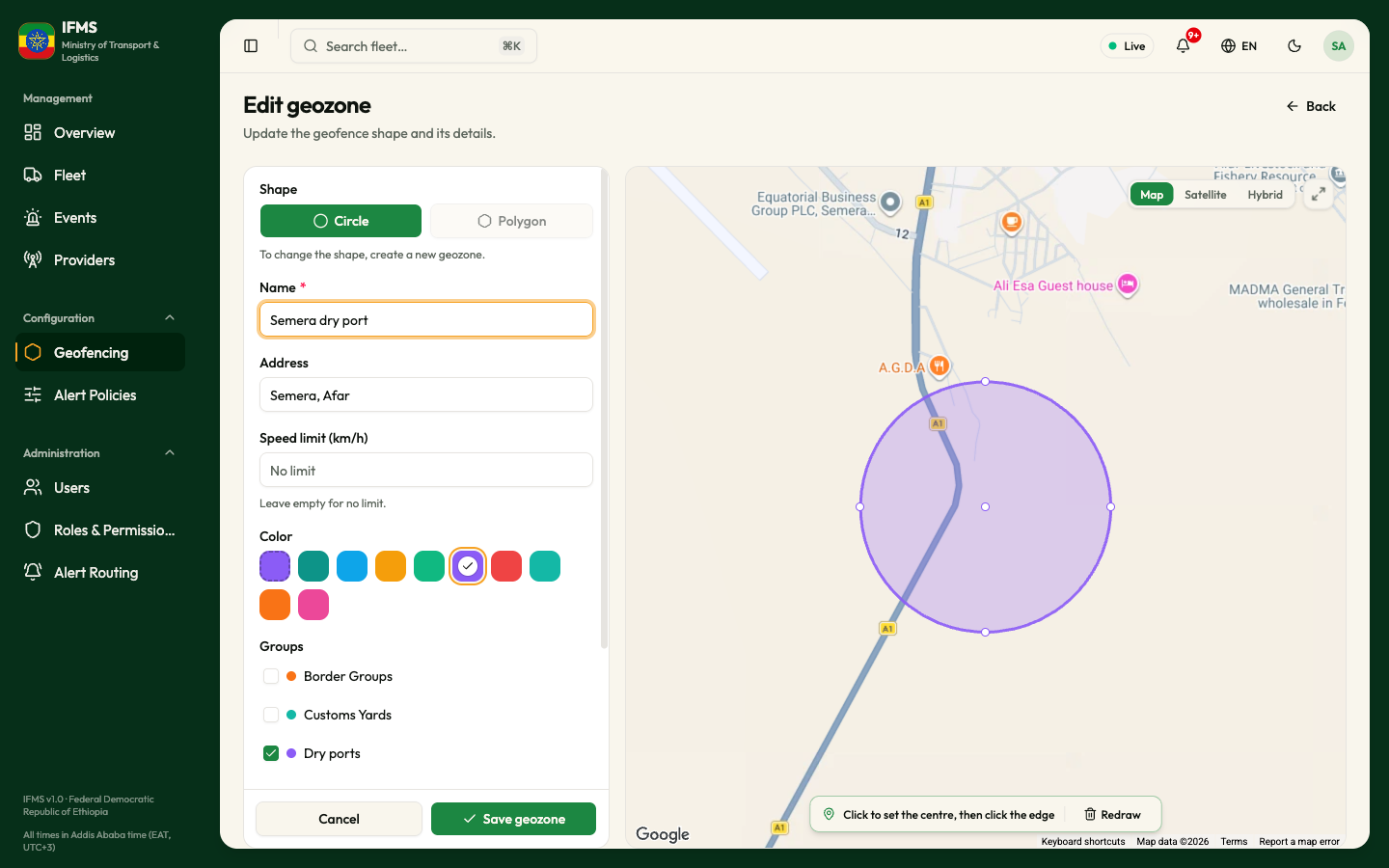
The screen is titled Edit geozone, with the line "Update the geofence shape and its details." Everything is filled in as it was saved.
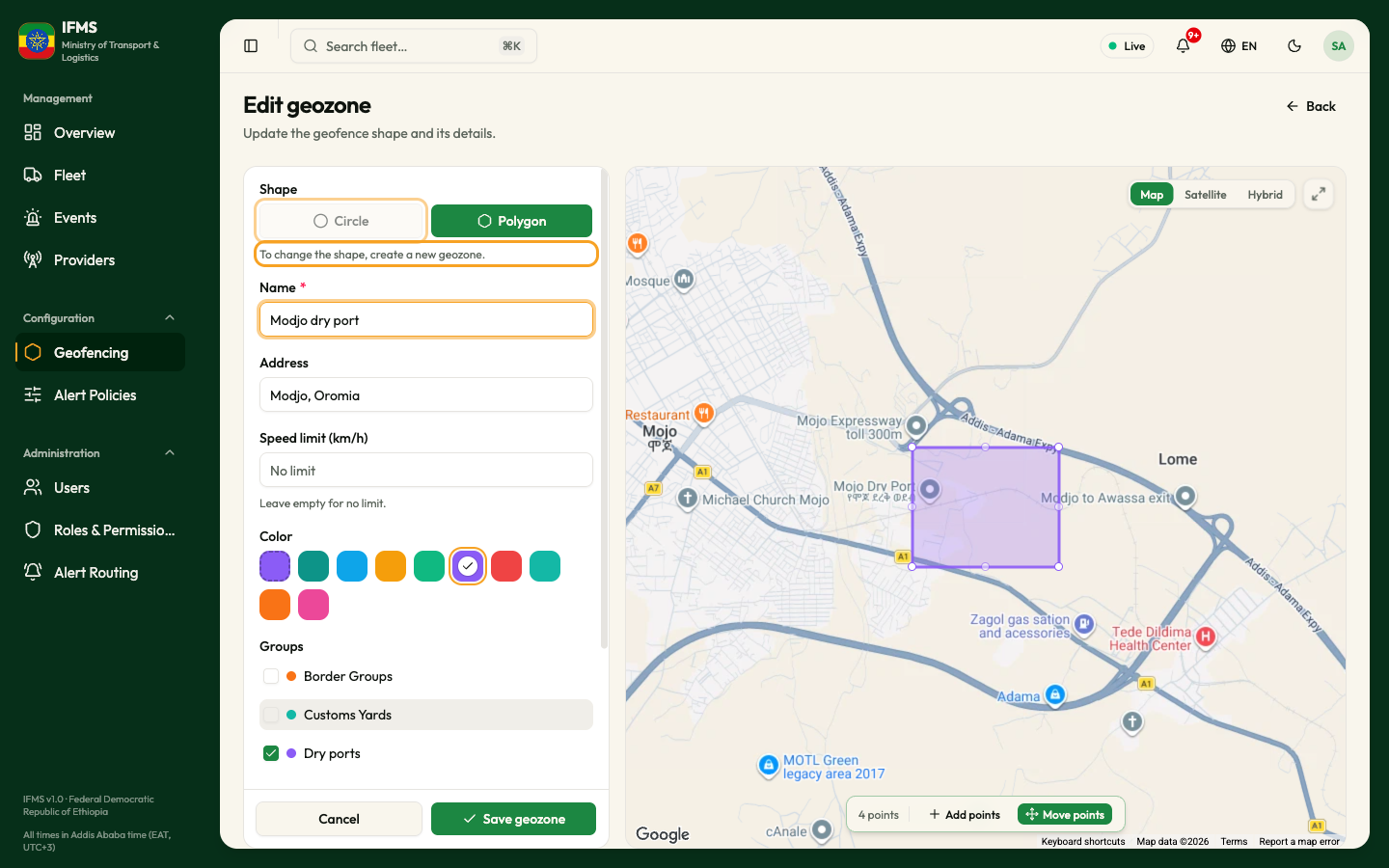
- The Shape cannot be changed. To turn a circle into a polygon, create a new zone and delete the old one.
- A circle can be dragged or resized, or replaced with Redraw.
- A polygon opens in Move points: drag its corners, or add corners from the handles on its edges. Select Add points to add corners at the end, with Undo and Clear.
- Emptying Speed limit (km/h) removes the limit, and choosing Use group colour removes the zone's own colour, when you save.
- Selecting Save geozone shows Geozone updated and takes you back to Geozones with the zone selected.
If something goes wrong
| What you see | What to do |
|---|---|
| Geozone name is required | Type a name in Name. |
| Another geozone already uses this name. (with the red message A geo-zone with this name already exists.) | Another zone in use has that name. Choose another name, or rename or delete the other zone. |
| Create geozone / Save geozone is greyed out, with "Draw the geozone on the map to save it" | Nothing is plotted yet, or the polygon has fewer than three points. Draw on the map. |
| Red text under Name, Address or Speed limit (km/h) | The value is too long or not accepted. For the speed limit, type a whole number above 0, or leave it empty. |
| A red message about the colour or the shape | The shape or colour was refused. Draw the shape again and save; if it keeps failing, report it with the name of the zone. |
| Geozone not found / "It may have been deleted. Deleted geozones can be restored from Show deleted on the Geozones page." | Someone has deleted the zone. Select Back to geozones, and restore it if it is still needed. |
| Couldn't load this geozone / "The request failed, so nothing is shown. It has not been deleted." | Select Try again. |