Overview
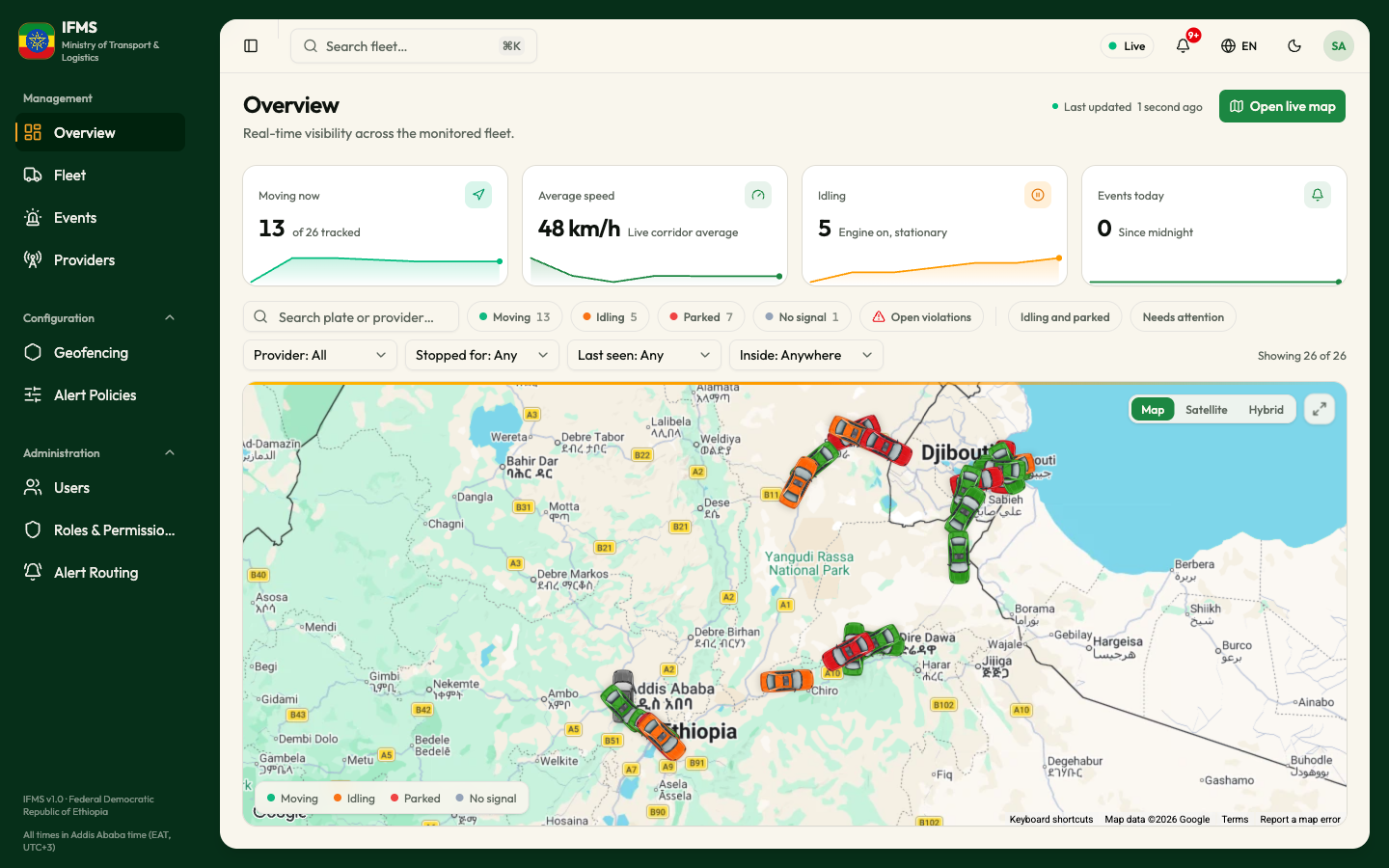
Overview is the first screen you see after signing in. It answers one question at a glance: what is the monitored fleet doing right now? Four cards give you the counts, and the map below them shows where each vehicle is.
Nothing on this screen is a form. You cannot change anything here; you read it, and then you open the screen that lets you act.
Overview, Fleet, search and all maps show only vehicles IFTMS says are legal. The counts do not include vehicles that are not legal or have no IFTMS answer yet. If a vehicle stops being legal, it disappears from every vehicle view. Its legality alert remains in Events.
Who can see this screen
Everyone. Overview is the one screen with no permission attached, so every signed-in person lands here.
Its links are a different matter. Open live map, clicking a vehicle on the map and the search results in the header all lead to screens that do need permission. If yours does not include them, you will see "Access denied" instead. See What each role can do.
How to open it
- Sign in. Overview is where you arrive.
- From anywhere else, select Overview in the sidebar, under Management.
The page header
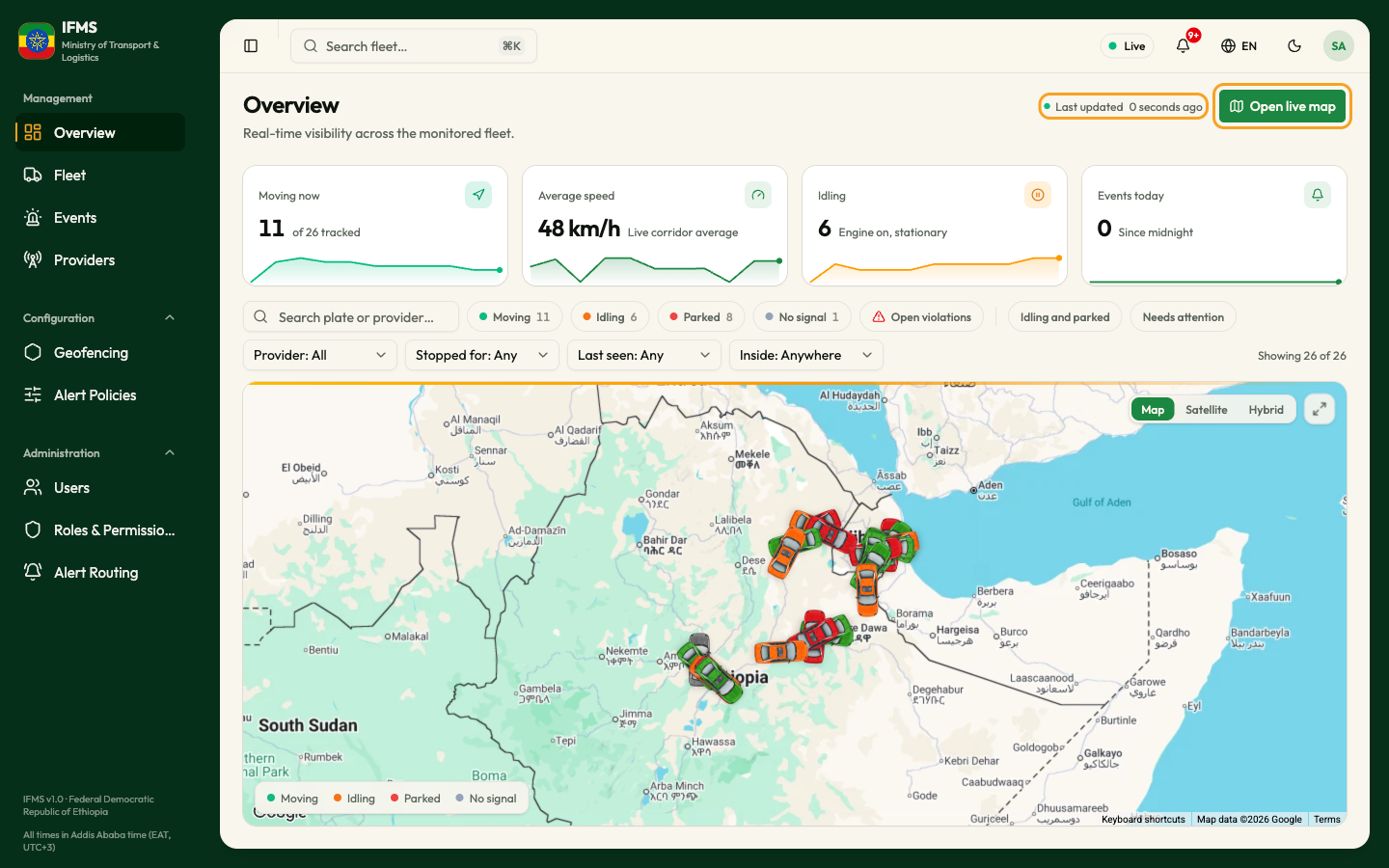
Last updated tells you how fresh the screen is - for example "41 seconds
ago". It is the time of the most recent report from any vehicle on the map,
not an average. Rest the mouse pointer on it to see the full date and time, in
the form 18 Sep 2026, 08:14. The text re-counts itself every 30 seconds.
When no vehicles are being monitored, Last updated is hidden entirely.
Open live map takes you to the Live map: the same vehicles, on a full page, with a table view.
If IFMS loses its connection to the position feed, it reconnects quietly in the background. While it is disconnected the markers freeze where they were and the Live dot in the header keeps showing green - nothing on screen tells you the data has stopped. Last updated is your only clue: if it climbs past a few minutes, what you are looking at is history. Reload the page.
The four cards

| Card | What the number is | The grey text beside it |
|---|---|---|
| Moving now | How many monitored vehicles are currently moving. | "of N tracked" - N is every vehicle on this screen, moving or not. |
| Average speed | The average speed of the moving vehicles only, rounded, as NN km/h. Vehicles that are stopped are left out, so they cannot drag the average down. When nothing is moving it reads 0 km/h. | "Live corridor average" |
| Idling | How many vehicles have their engine running while standing still. | "Engine on, stationary" - this is the only place IFMS defines idling. |
| Events today | How many alerts have been raised since midnight, local time. The bell turns red as soon as this is above zero. It refreshes every minute. | "Since midnight" |
The cards are not buttons: selecting one does nothing. To act on the alerts counted in Events today, open Events.
Each card has a thin line along its bottom edge with a pulsing dot at the end. It is a rough sense of movement over the last few minutes, not a record you can measure - when the page first loads, most of that line is drawn from a smooth placeholder shape rather than from real readings. Treat it as decoration; take the number as the fact.
The map
The map fills the rest of the page. Every monitored vehicle is a car-shaped marker, turned to face the direction it is travelling.
What the colours mean
The legend at the bottom left of the map lists the colours. Each state has its own colour:
| Marker | Meaning |
|---|---|
| Green car | Moving - travelling faster than 3 km/h |
| Orange car | Idling - standing still with the engine on, or with the engine state not reported |
| Red car | Parked - standing still with the ignition off |
| Grey car | No signal - no fresh position for more than 10 minutes |
A vehicle whose state the portal does not recognise is shown in pale grey as Unknown. To see more about one vehicle, rest the pointer on it.
Where the map starts. The first time positions arrive, the map zooms out just far enough to fit every vehicle on screen. After that it never moves on its own, so any panning or zooming you do is kept while you stay on the page. One vehicle parked far from the corridor is enough to zoom the whole map out; scroll in on the corridor to see the rest clearly.
Moving around the map
- Zoom: scroll wheel, or a two-finger swipe on a trackpad.
- Pan: drag the map.
- Change the background: the Map | Satellite | Hybrid buttons at the top right. Map is the plain drawn map and is the default; Satellite is photography; Hybrid puts road and place names on top of the photography.
- Fill the window: the expand button at the top right.
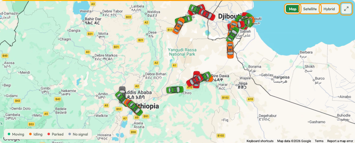
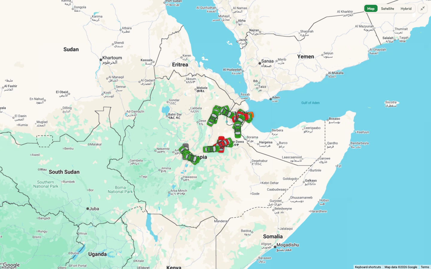
Full view grows the map until it fills the whole browser window, which is
the comfortable way to watch the corridor. The same button, now labelled Exit
full view, brings it back - and so does pressing Esc.
Looking at one vehicle
Rest the mouse pointer on a marker and a small card appears.
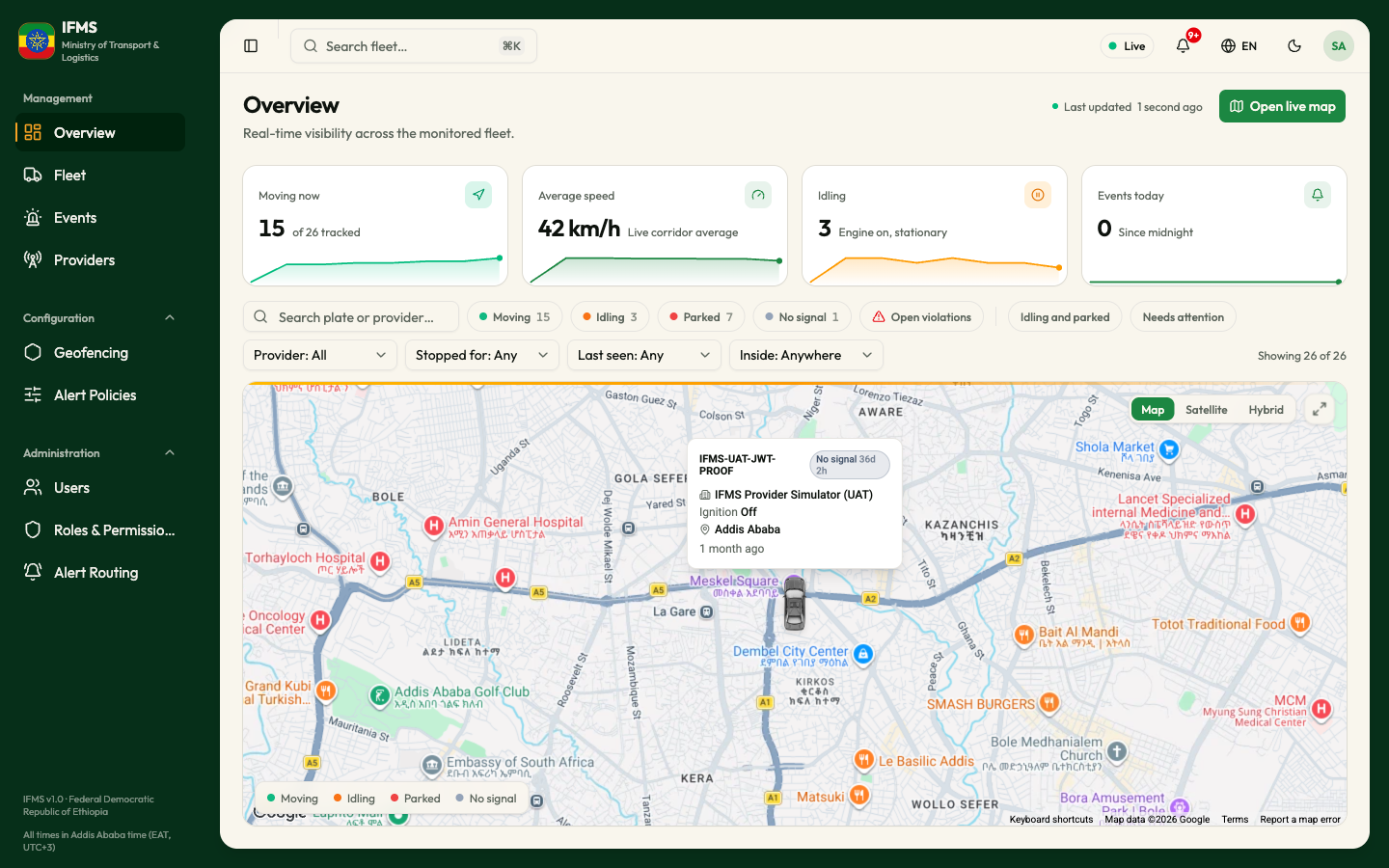
The card shows, when IFMS knows them:
- The plate, in bold, and a coloured status pill.
- The operator the vehicle belongs to, with a building icon.
- Speed, in
km/h- only while the vehicle is moving. - Where it is: the nearest corridor town, shown either as the town's name when
the vehicle is within about 12 km of it, or as
near <town>when it is further away. - Inside
<area name>, if the vehicle is inside one of the watched areas. - How long ago the vehicle last reported.
Selecting a marker opens that vehicle's own page, where you get its full record and its recent history. See Vehicle details.
On a touchscreen there is no way to hover, so tapping a marker goes straight to the vehicle's page and the card never appears. The card's wording also stays in English when the rest of the portal is in Amharic.
When the screen is empty
IFMS shows no spinner and no "nothing here" message on this page. If no vehicles
are being monitored you simply get a map at its default position with no
markers, all four cards reading 0, and no Last updated time. That is
normal on a quiet system; if you expected vehicles, reload the page, and if they
are still missing see Troubleshooting.