Geozones
A geozone is an area on the map that IFMS watches: a border post, a dry port, a customs yard, a weighbridge. A geozone on its own does nothing — it raises no alert and sends no message. It becomes useful when an alert policy points at it, for example "tell the command centre when a truck enters Galafi border crossing". The geozone says where; the policy says what to watch for and who to tell.
The Geofencing screen is the catalogue of those areas. It shows every zone on one map, with a list beside it that you can search and group.
Geozones come in two shapes: a circle (a centre point and a radius) or a polygon (three or more corner points). See Key concepts for how geozones fit into the rest of IFMS.
Who can see this screen
Anyone whose role allows them to see geozones: Operator, Supervisor, Operational manager and System admin. If your role does not include it, Geofencing is missing from the sidebar.
Creating, changing, deleting, restoring, importing and switching zones on or off need extra rights. Where you lack one, the button or menu item is not shown, and an Active switch you may not move is greyed out. See What each role can do.
How to open it
- In the sidebar, open Configuration.
- Select Geofencing.
You can also type the name of a zone in the search box at the top of the screen (Search fleet…) and choose it under Geozones; the Geofencing screen then opens with that zone already selected.
The screen at a glance
| Region | What it holds |
|---|---|
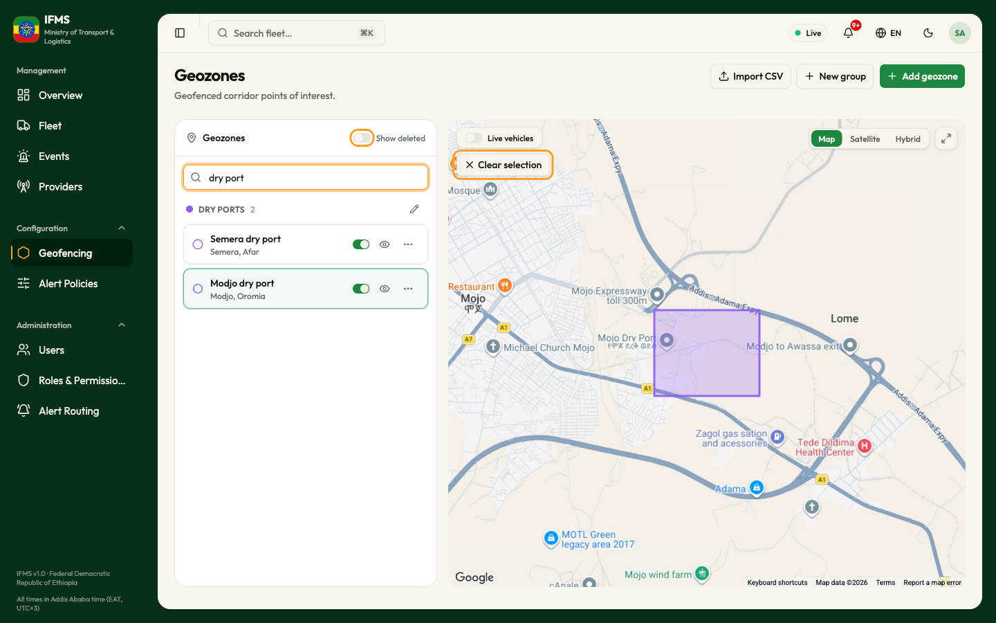
| Page header | The title Geozones, the line "Geofenced corridor points of interest.", and the buttons Import CSV, New group and Add geozone. |
| Left panel | The Geozones list: the Show deleted switch, a search box and every zone, sorted into its groups. |
| Map | Every switched-on zone you have not hidden, drawn in its colour, plus the Live vehicles switch, Clear selection while a zone is selected, and the map controls. |
The three header buttons are the starting points for the other tasks in this chapter:
| Button | What it does |
|---|---|
| Import CSV | Opens a window where you paste or upload a list of points and create several zones at once. See Import geozones from a CSV file. |
| New group | Creates a colour-coded group. A zone without its own colour is drawn in its group's colour. See Geozone groups. |
| Add geozone | Opens the editor, where you draw one zone and fill in its details. See Draw a geozone. |
The list of zones
Search
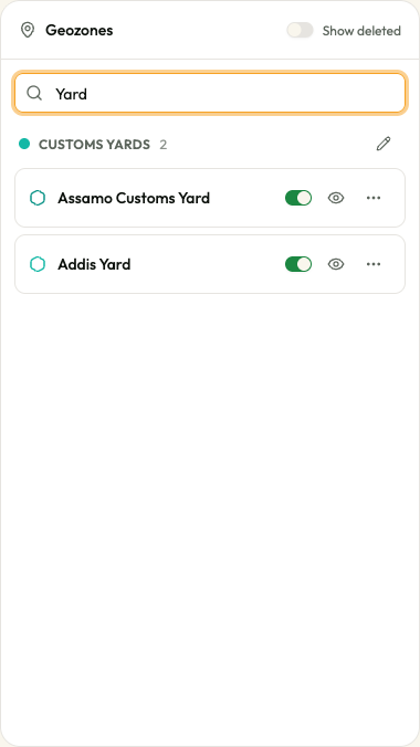
Type in Search geozones… to shorten the list. IFMS matches what you type against the zone name and its address, in any position and ignoring capital letters. It does not match group names.
Groups
Zones are shown in sections, one per group. Each section header carries the group's colour dot, its name in capitals, the number of zones in it and, if your role may change groups, an Edit group pencil. Sections are in alphabetical order, and UNGROUPED — the zones that belong to no group — always comes last.
- A zone that belongs to several groups is listed under each of them.
- A group with no zones in it is still listed, with the line No geozones in this group. While you are searching, groups with no matching zones are left out.
A row in the list
| Part of the row | What it means |
|---|---|
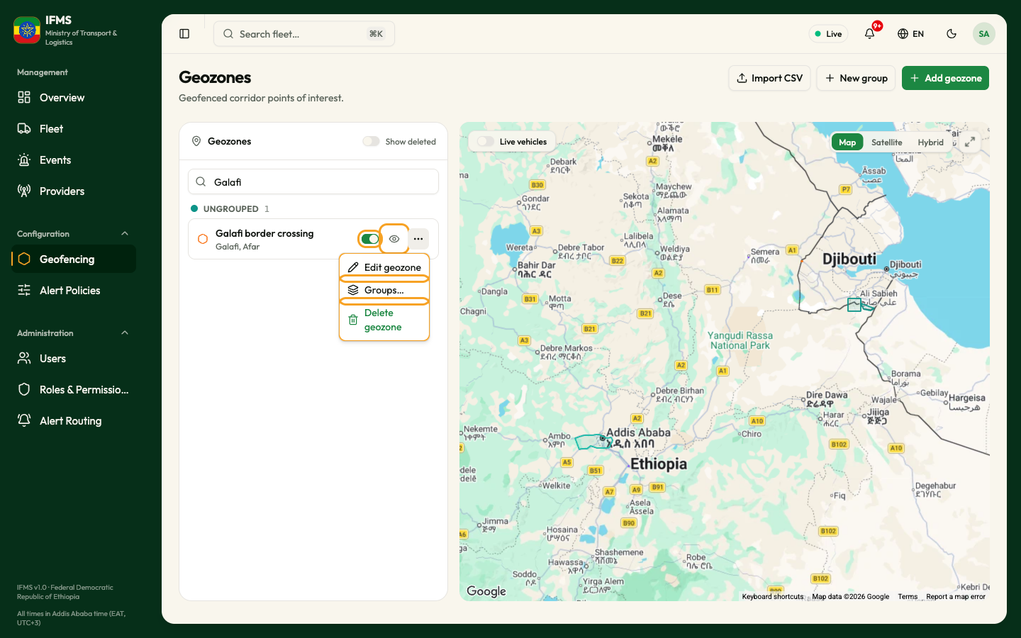
| Shape icon | A circle for a circular zone, a six-sided shape for a polygon, in the zone's colour. |
| Name | The zone's name. It turns grey when you have hidden the zone on the map. |
| Inactive | A grey badge shown when the zone is switched off. |
| Address | The second line, when the zone has one. |
| Switch | Whether the zone is active. See Switching a zone on and off. |
| Eye button | Hide on map / Show on map. Only changes your own view; see Hiding a zone from the map. |
| ⋯ button | The row's menu: Edit geozone opens the zone in the editor; Groups… puts the zone into groups; Delete geozone deletes it. Items your role does not allow are left out, and the button is not shown at all when none is allowed. |
Selecting a zone
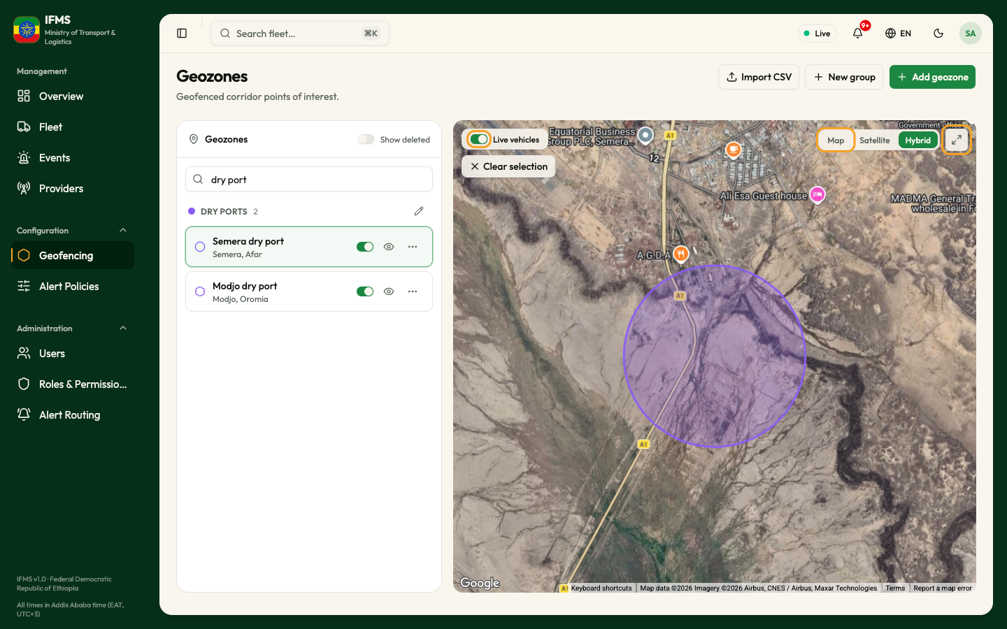
Select a row — by clicking it, or with Enter or the space bar — and two things happen: the row is outlined, and the map zooms to that zone and draws it with a thicker outline and a stronger fill. Clicking the zone's shape on the map selects it in the same way, and scrolls the list to its row.
To go back to seeing every zone, select Clear selection at the top left of the map, or press Esc.
The map
The map draws every switched-on zone that you have not hidden. A zone that is switched off is not drawn. A zone is drawn in its own colour; a zone that has no colour of its own takes the colour of its first group in alphabetical order, and a zone in no group is drawn in teal.
| Control | Where | What it does |
|---|---|---|
| Live vehicles | Switch, top left of the map | Off to begin with. Switch it on to see legal vehicles, drawn as small cars pointing in the direction of travel. Point at a car to see its plate, provider, movement state, speed, nearest place and last report time. The switch returns to off when you leave the screen. |
| Clear selection | Button under Live vehicles, while a zone is selected | Shows every zone again. |
| Map, Satellite, Hybrid | Buttons, top right | The background: a drawn map, aerial imagery, or imagery with names and roads on top. |
| Full view | Button with arrows, top right | The map fills the window. The button becomes Exit full view (Esc); the Esc key does the same. |
| Right-click | Anywhere on the map | Shows the coordinates of that point, with Copy coordinates (the message Coordinates copied confirms it) and Dismiss. The card disappears by itself after about eight seconds. |
The map frames itself when the screen opens — on all the switched-on zones — and when you select a zone. Hiding or showing a zone does not move the map.
Switching a zone on and off
The switch on a row says whether IFMS is watching that zone.
- Select the switch on the zone's row.
- The message "zone name" activated or "zone name" deactivated confirms the change.
There is no confirmation question, and the switch only moves once the change has been saved, so it may take a moment. A zone that is switched off stays in the list with the Inactive badge, disappears from the map, and alert policies stop testing vehicles against it: nothing will be raised for that area until you switch it back on.
Some roles may switch zones in one direction only. The switch is then greyed out when it is in the position you may not change.
Hiding a zone from the map
The eye button on a row removes that zone's shape from the map to clear the view. It changes nothing for anybody else, nothing is saved, and every zone is back the next time the screen loads.
Deleting and restoring a zone
Deleting a zone takes it out of the list and the map, and IFMS stops watching it. It is not erased: switch on Show deleted to see it and Restore it. A zone an alert policy points at cannot be deleted until the policy is changed. See Delete and restore a geozone.
Empty screens and problems
| What you see | What it means |
|---|---|
| Five grey bars in the list | The zones are still loading. |
| No geozones / "No geozones match your search." | Nothing matches what you typed in Search geozones…. Clear the box. |
| No geozones / "Add a geozone to start monitoring corridor points of interest." | There are no zones at all, or the list could not be loaded. A red message appears as well when loading failed; try again in a moment. |
| No geozones yet over the map, with "No geozones yet. Create one with Add geozone, or import a CSV." | There are no switched-on zones to draw. Use Add geozone or Import CSV, or switch a zone on. |
| A red box "Groups could not be loaded, so zones are shown without their groups." with Try again | The zones are fine, but the groups could not be read; the zones are shown as one list without headings. Select Try again. |
| No deleted geozones | Show deleted is on and nothing has been deleted. |
Tips
- Search for the zone before you edit or delete it. The list is short now, but a corridor fills up quickly, and a search of one or two words puts the right row in front of you.
- To colour a set of zones alike — dry ports in one colour, border posts in another — give their group a colour and leave each zone on Use group colour.
- Before you switch a zone off, check which policies use it — switching the zone off silences all of them at once.
Related pages
- Draw a geozone
- Delete and restore a geozone
- Import geozones from a CSV file
- Geozone groups
- Alert policies
- Reports & Analytics